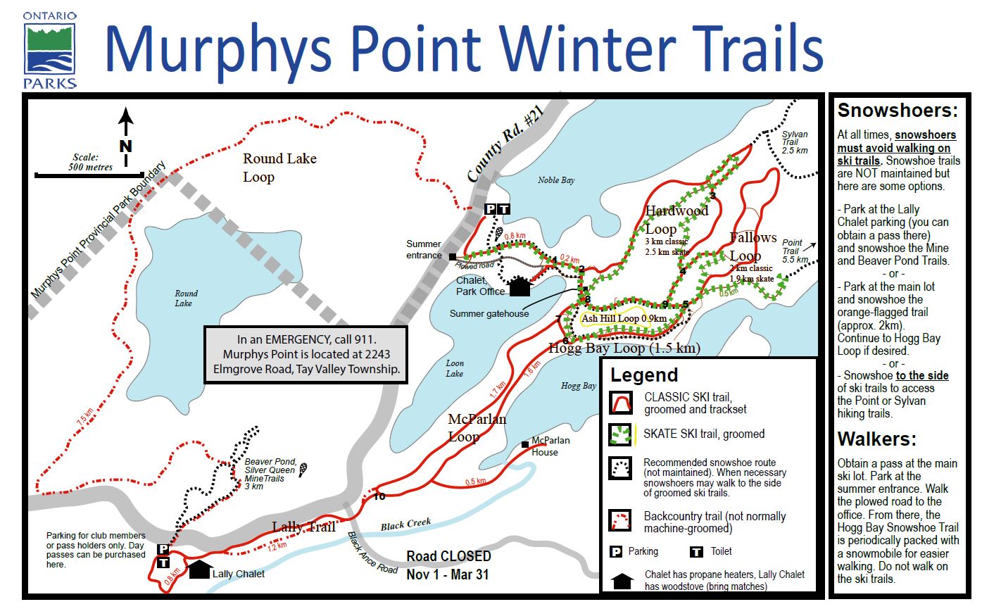
About the trail network
Our 22 km network consists of 12 km of track-set trails for classic skiing and 6 km groomed for skate skiing. In addition, there are 10 km of backcountry trails. Skiers who enjoy the solitude of nature should take advantage of the Round Lake Loop, suitable for intermediate backcountry skiers.
Facilities
We are very pleased to announce that Murphys Point Provincial Park is providing a new warm up hut with woodstove and seating for the 2026-27 season. More on this as the next season develops
Location
The trail network is located at Murphys Point Provincial Park on the shores of Big Rideau Lake in Eastern Ontario. Situated on the Frontenac Arch extending southeastward from the Canadian Shield, it offers an ideal environment for recreational and competitive skiing and snowshoeing. The network also provides access to several archaeological sites and restored heritage buildings that serve as rest stops on the trail.
Etiquette
Please note: Hiking and dogs are not permitted on the ski trails. Snowshoers are welcome to travel beside the groomed portion of the trails to access nature trails, but must stay off the groomed surface.